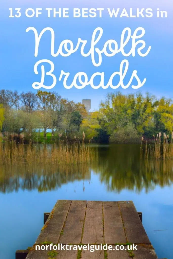
Flat, tranquil and bursting with nature and wildlife, where better to walk than the Norfolk Broads? If you enjoy a long-distance hike, a circular walk or a quick leg stretch, then the Broads is a wonderful place to find a route and get some miles on the legs.
From multi-day national trails, to walks amongst the peaceful inland waterways, through pretty Broads villages and past local iconic landmarks, there are walks here for dog lovers, serious hikers and families alike.
I’ve put together a guide of my favourite walks in the Norfolk Broads, with links to downloadable walking maps and specific directions. All you need to do is pack a picnic, get your boots on and get walking!
RELATED POST: The Ultimate Local’s Guide to Norfolk England
This post may contain affiliate links. If you book something I recommend, I make a small commission without affecting the price you pay!
The Wherryman’s Way
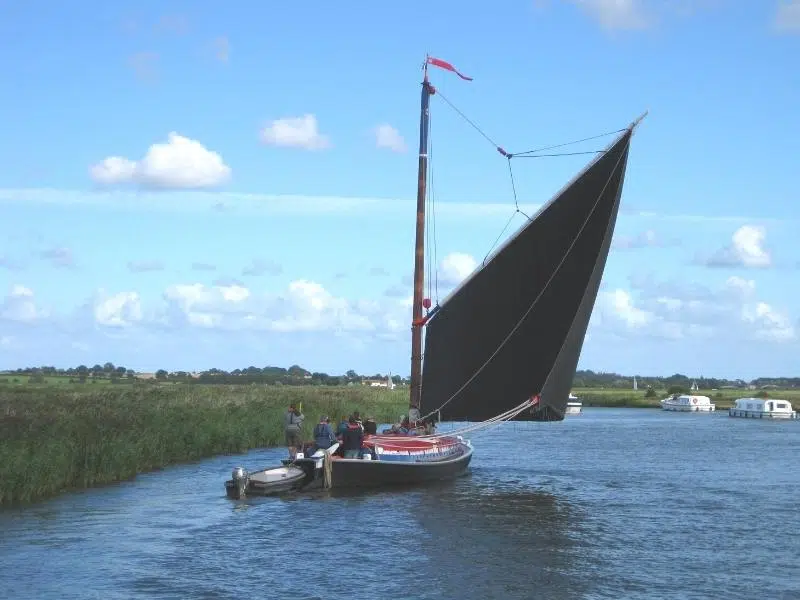
The best of the Norfolk river walks, the Wherryman’s Way can be walked or cycled and starts at the riverside opposite Norwich train station before meandering all the way along the attractive River Yare on the Norfolk Broads, to the railway station in Great Yarmouth.
The route is named after the locals who plied their trade in traditional Norfolk wherries, boats which have been part of life on the Broads for hundreds of years. Sadly there are only eight remaining wherries on the Broads from a cast of hundreds in the 19th century. You can sometimes see their distinctive sails across the fields as they move along the inland waterways.
The 37 mile route passes historic ruins, pretty villages, riverside pubs and Sites of Special Scientific Interest, which reflect the rich wildlife diversity of the Yare Valley. Whether you are lucky enough to spot rare species, or enjoy the abundant and colourful landscape, you will not be disappointed.
The Wherryman’s Way is followed by public transport almost all the way from start to finish, meaning that you can walk or cycle as much of the path as you want and catch a bus or train back to your starting point, and your holiday accommodation. This is ideal if you don’t want to go too far, or you’re walking with small children.
There are twelve circular walking routes link up with The Wherryman’s Way, ranging from 1.5 miles to 7.5 miles in length, so there will definitely be a route to suit your timeframe. Waymarkers along the route include stainless steel wherry sails, life-like figures, information panels and audio points, which help to make the walk engaging for kids.
This excellent book The Wherryman’s Way, by Norfolk local hiker Joe Jackson, includes maps and directions of the entire trail with suitable overnight stops and locations of all facilities, points of interest and public transport information, and will help you get the most from the trail, especially if you’re planning to walk the full 37 miles.
Links with:
- The Weavers’ Way at Great Yarmouth as it heads through the Broads to Cromer.
- The Neslon Way, also at Great Yarmouth, a 404 mile long distance route from Burnham Thorpe in North Norfolk (Nelson’s birthplace), and linking locations associated with Admiral Lord Nelson.
- Bramerton Riverside Walks at Bramerton on the River Yare.
RELATED POST: 22 Fantastic Things to Do in Wroxham
The Angles Way
Devised by the Ramblers, The Angles Way National Trail is a 93 mile walking trail which follows the county boundary of Norfolk and Suffolk, through the Waveney Valley and Little Ouse Valley, from Great Yarmouth through to Thetford.
There are lots of excellent Norfolk Broads circular walks which incorporate parts of the Angles Way, from 7 miles to 2 miles long. You can download a PDF map of the Angles Way Trail before setting out. If you’re planning on cycling the route, then a mountain bike or crosstrail bike is advisable as the route can be uneven in places.
One of the best Great Yarmouth and Gorleston-on-Sea walks and my favourite parts of the Angles Way just inland from the town, is the Burgh Castle walk.
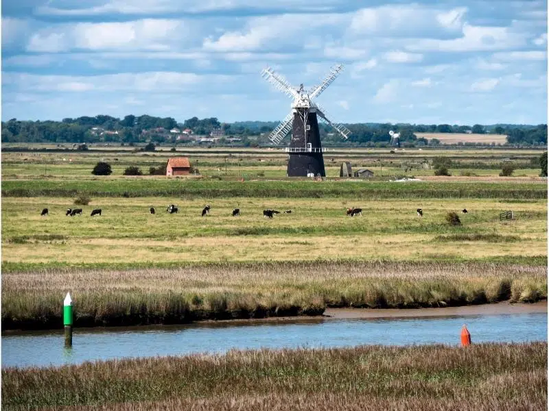
You can ramble around the majestic third century Roman flint walls at the castle and on a clear day, you can see for miles with panoramic views across the River Yare and River Waveney to the grazing marshes, and the distinctive Berney Arms windmill in the distance.
From the ruins, head to the river and join the Angles Way to Great Yarmouth. At the river, turn right and you’ll find the path that runs alongside the river, before arriving at Breydon Water where the sea meets the Broads.
From here, the path takes you to the Breydon Bridge, where you can cross the river back into Great Yarmouth. This walk one way is four miles, which will take around an hour and a half at a relaxed pace.
Links with:
- The Peddars Way at Knettishall Heath in the Suffolk Brecks, which runs all the way to the North Norfolk coast at Holme and the Norfolk Coast Path.
- The Bouddica Way at Diss, which heads through the rolling countryside of south Norfolk to Norwich.
- At Great Yarmouth pick up both the Wherryman’s Way to Norwich, passing through the Yare valley and Weavers Way heading through the Broads to Cromer.
RELATED POST: 26 Exciting Things To Do On the Norfolk Broads
The Weavers’ Way
The Weaver’s Way runs from Cromer for 61 miles through the Norfolk countryside, taking in the National Trust properties of Blickling Estate and Felbrigg Hall, the pretty village of Hickling, iconic Thurne Mill and Breydon Marshes before, arriving at Great Yarmouth on the east coast of Norfolk.
Named after the weaving industry which dominated medieval trade in Norfolk, this historic trail passes through a diverse landscape of woodland, mixed farmland, historic country estates, disused railway lines and riverside walks, showing off the best of the Norfolk Broads.
There are nineteen circular walks branching off the Weavers’ Way, ranging from 1.25 miles to 7 miles long, so there’s something for everyone along this beautiful trail.
One of my favourites is the Potter Heigham 5.8 mile circular walk, which takes you across the Potter Heigham medieval bridge, believed to date from 1385, and through beautiful lush meadows and the woodlands of Hickling Broad National Nature Reserve before returning alongside the River Thurne to the village, where you can treat yourself to lunch or afternoon tea! You can download a map of this walk with detailed instructions here.
Links with:
- At Cromer, join the Norfolk Coast Path (which heads west, right along the coast to Hunstanton) or the Paston Way (which meanders along to link again with Weavers’ Way, in North Walsham).
- At Aylsham join the Marriott’s Way to Norwich.
- At Great Yarmouth pick up either the Wherryman’s Way to Norwich along the Yare Valley or the Angles Way along the Waveney Valley.
RELATED POST: 14 Stately Homes in Norfolk to Visit
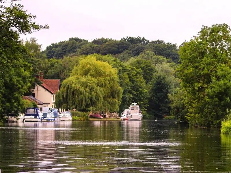
Bramerton Riverside Walks
The Bramerton Riverside Walk is a circular walk of 3 miles which begins at Bramerton Common and follows the banks of the River Yare towards Surlingham before completing a loop along footpaths and green lanes back to Bramerton. You can download a map and directions here.
Along the river you’ll see ducks, geese and herons. You can also spot owls hunting on the marshes, and beautiful kingfishers and colourful dragonflies in the summer months.
At the riverside Woods End pub look out for the statue of Billy Bluelight (William Cullum), a popular flower seller and cult figure in Norwich. He was well known for his races, when he would run the 20-mile stretch alongside the steam pleasure boats beside the Rivers Wensum and Yare to see if he could beat them to the finish line.
As you arrive back at Bramerton, take time to visit the Bramerton Pits, a geological Site of Special Scientific Interest important in the study of the Lower Pleistocene era which has yielded rich, mainly marine vertebrate fossils.
Links with:
- The Wherryman’s Way on the River Yare section at the Woods End pub.
RELATED POST: 31 Amazing Things To Do in Norwich
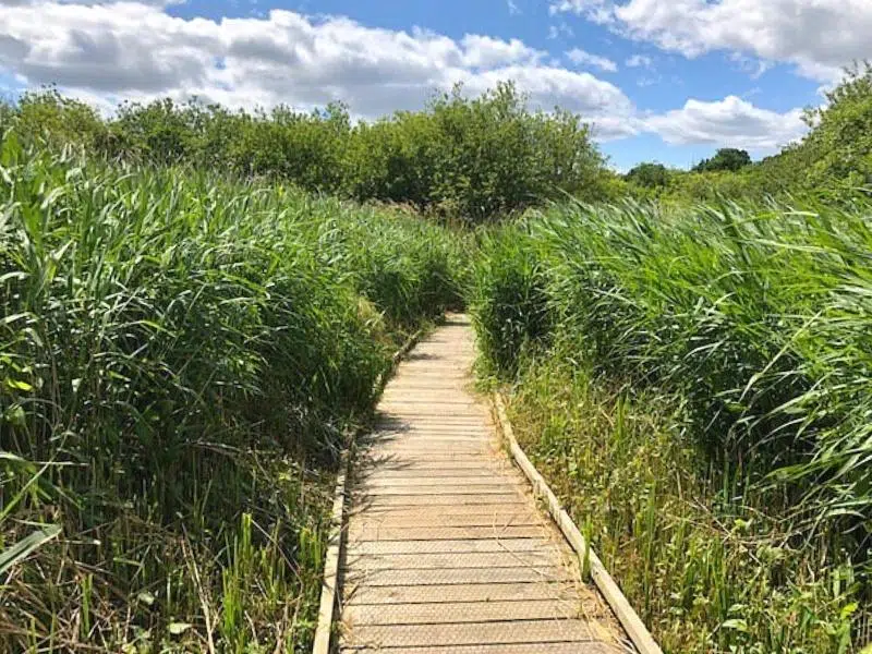
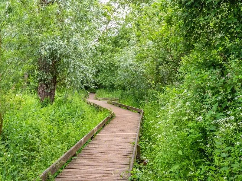
Barton Broad Boardwalk
Off the beaten path Barton Broad is one of my favourites. Park in the car park in the nearby village of Neatishead before walking east along Irstead Road, for around fifteen minutes, to the start of the wheelchair and pushchair friendly boardwalk.
The 1.5 mile trail leads you through swampy, wildlife filled woodland, with resting places and information boards where you can read about the wildlife, before emerging onto a large viewing platform. From here you can enjoy a fantastic panoramic view over Barton, second largest of the Broads.
If you’re looking for family adventure, hire a canoe at Wayford Bridge and paddle down the River Ant to Barton Broad, and moor at Neatishead staithe. From here you can walk the boardwalk and reward yourself with a drink at the nearby Whitehorse Inn, or bring a picnic and eat it on the pretty staithe.
RELATED POST: 30 of the Very Best Things To Do in Norfolk
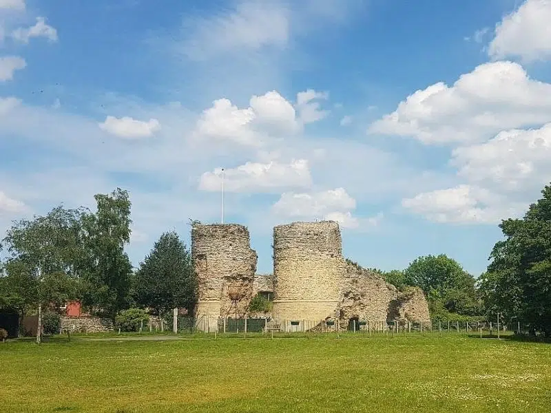
The Bigod Way
Although this route starts in the Suffolk market town of Bungay, the area is still referred to as the Norfolk Broads, so I’m including it! Bigod Way is 5.5 mile circuit in the Waveney Valley and countryside around Bungay, which can be reached from Bigod’s Castle, a Grade I Norman castle built around 1100CE.
The route passes through areas of outstanding natural beauty and offers a variety of wildlife, rare plants, and sites of historical interest. Following the River Waveney to the village of Earsham, the route then climbs the Bath Hills that overlook the whole area, providing panoramic views once you’ve scaled the 150m elevation gain to the top.
From the hills, you descend to the village of Ditchingham, home to the Duke of York pub, the perfect place to stop for a bite to eat and a well earned drink! You can download a PDF map of the route with details here.
Links with:
- Much of the route coincides with the Angles Way as it encircles Bungay and Outney Common near the River Waveney.
- South of Bungay there is a mile of so where the Bigod Way coincides with the Waveney Way, a 71 mile looped trail that starts and ends at Ness Point in Lowestoft.
- Via Beata (Way of Blessing) to the North of Bungay, a long distance path from Lowestoft in Suffolk to St David’s in Pembrokeshire.
RELATED POST: 12 Norfolk Castles for You to Explore
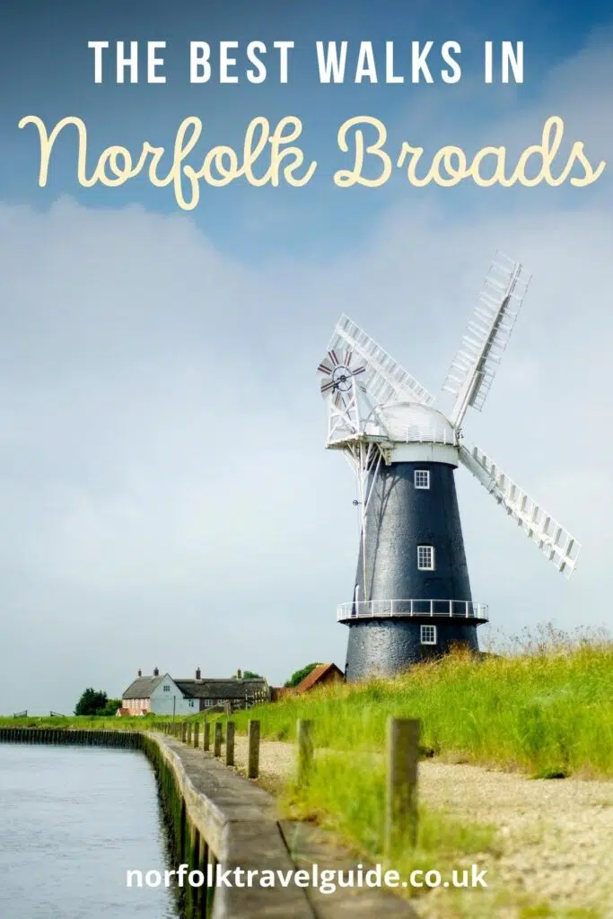
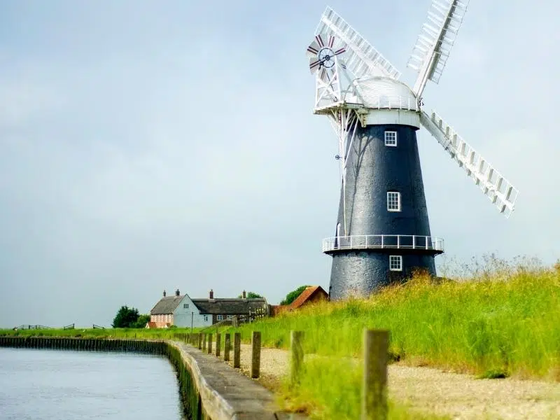
Horsey Mill Walk
Horsey, where the Norfolk Broads meet the coast, is a remote and secluded location, perfect for walking and bird watching throughout the seasons. There is an easy 3.8 mile circular walk from Horsey Mill to Horsey Gap beach, where you can also see the seal pups between late October through to February.
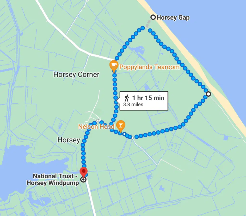
The Horsey Windpump car park is owned by the National Trust, and parking there if free for members. Or park at the Nelson Head car park in the village, pop in and let them know you’re there, and then have a drink or lunch after your walk.
Most winters, over 2,000 seal pups are born, and it’s an incredible sight as you walk over the dunes to the viewing platform. Even if you’re visiting in summer, you’ll see seals bobbing along in the sea – popping up to have a nose when they know people are on the beach!
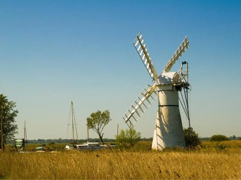
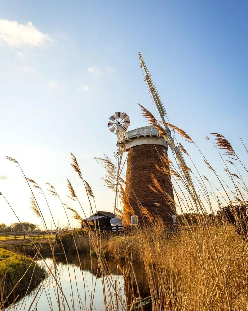
Horsey Windpump is an iconic 20th century drainage mill with a fascinating past. Standing watch over the Horsey Mere, a climb to the top is rewarded with stunning panoramic views of the surrounding countryside and Broadland landscape.
Horsey Windpump is owned by the National Trust, who restored the building after the mill was struck by lightening in 1943 and abandoned for 75 years. Now complete with a winding cap and turning sails, this delightful Grade II* listed building is ridiculously photogenic.
Links with:
- The Norfolk Coast Path as it heads south at Horsey Gap.
RELATED POST: Seals in Norfolk – Where & How to See Them
Hoveton Great Broad Nature Trail
A wonderful one hour walk for families, the Hoveton Great Broad Nature Trail can be reached by boat between April and October, and there are free moorings for those enjoying boating holidays on the River Bure.
To get to the start of the trail, park at Salhouse Broad car park and head to the nearby moorings for the passenger ferry that links the moorings with the beginning of the trail.
Hoveton Great Broad is one of the largest and most secret lakes in the Broads, and is part of the Bure Marshes National Nature Reserve, along with Ranworth, Cockshoot and Decoy Broad.
The nature trail has been popular with visitors since 1968, after being developed by conservationist Dr Martin George. The trail has been designed to showcase the best of the broad including great tussock sedge, royal fern and undisturbed wet woodland, and as much of the route is on an island, it offers visitors an opportunity to experience the landscape of the Broads devoid of almost all human influence.
The walk route is staffed by wardens seven days a week throughout the summer season and you’ll enjoy a fantastic insight into the unique wildlife and flora of the Broads, and learn about what makes them so special.
RELATED POST: Norfolk Nature Reserves – Ultimate A-Z Guide
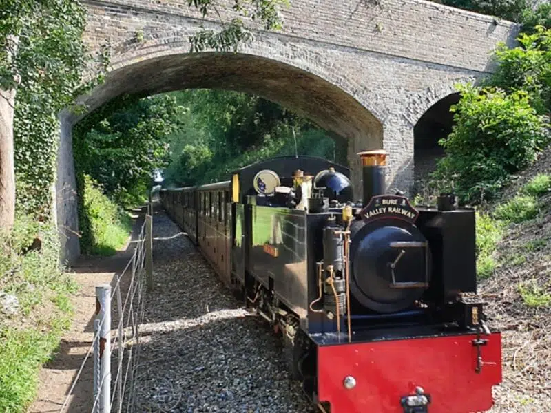
Bure Valley Path
Owned and managed by Broadland District Council, the Bure Valley Path is a nine mile footpath and cycle path which follows the brilliant narrow guage Bure Valley Railway, which runs between the historic market town of Aylsham and the bustling village of Wroxham
The route takes walkers and cyclists through the beautiful Bure Valley countryside following the meandering River Bure, through meadowland and ancient pastures, dotted with sheep and cows, and several picturesque Broads like Brampton, Buxton and Coltishall (perfect for the excellent Recruiting Sergeant pub)!
Whether you’re hopping on and off the Bure Valley Railway or taking a longer trip, the Bure Valley Path is a great trail to discover on foot, or by bike. With the Bittern Line between Norwich and Sheringham stopping at Hoveton and Wroxham it’s easy to leave the car behind.
If you decide to cycle the path, hire your bikes from Broadland Cycle Hire in Horning, a 15 minute ride from the start to the path at Wroxham station.
Links with:
- At Aylsham, pick up the Marriots Way Heritage Trail, a 25 mile footpath, cycle path and bridleway between Norwich and Aylsham.
RELATED POST: Aylsham: A Historic Market Town in Norfolk
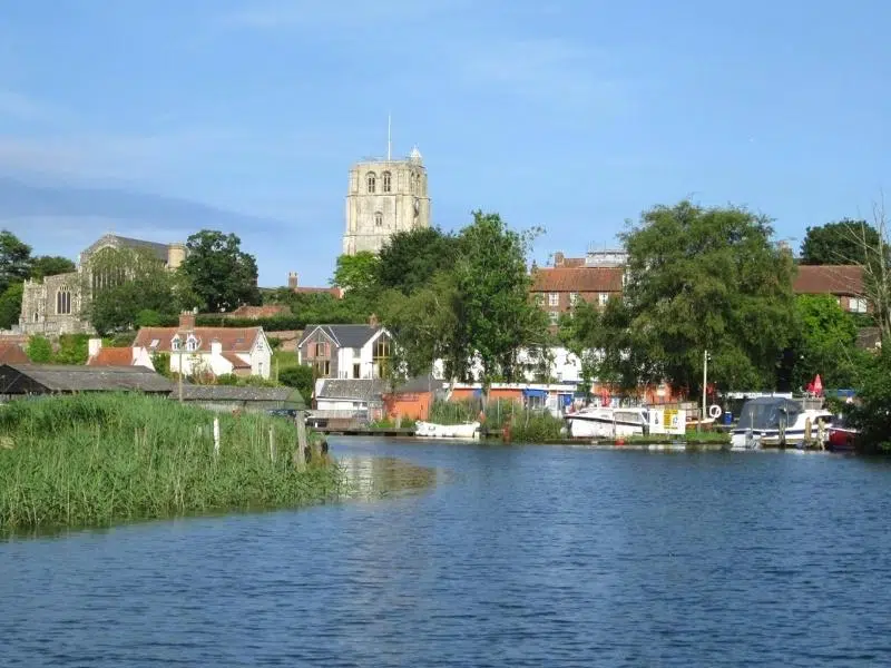
Beccles Marsh Trail
Another cross county border trail in the Broads National Park, the Beccles Marsh Trail is in the Suffolk Broads, but it’s all in the Broads so I’m including it!
The 4 mile circular trail starts at Beccles Quay and follows the River Waveney past an historic Iron Age Causeway and around the Beccles Marshes, which are grazed by cattle and criss-crossed by small dykes. Find a PDF map of the route here.
The area is full of interesting wild flowers and wildlife, home to nesting birds in spring, and birds of pray like kestrels, harriers and owls year round. There are an abundance of butterflies and insect life in summer, and you may be lucky enough to spot a kingfisher.
Links with:
- The start of the walk links with the Angles Way, Via Beata and the Waveney Way.
- You can also link with the the East Suffolk Line Walks, paths which follow the railway from Ipswich and Lowestoft, traversing some of the most delightful of Suffolk’s unspoilt countryside.
Muck Fleet Dyke Walk
Nestled between Norwich and the Norfolk coast, Fleggburgh (also known as Burgh St Margaret) is situated to the west of the Trinity Broads complex within the Broads National Park.
The circular 7 mile Fleggburgh to Stokesby walk starts at Fleggburgh village hall and takes in both Burgh Common and Muckfleet Marshes as it passes areas with unqiue Broads wildlife, the River Bure and picturesque windmills along Muck Fleet Dyke.
Pop into the pretty village of Stokesby for a rest and lunch at The Ferry Inn situated alongside the river, before continuing your walk back to Fleggburgh. Download a printable map here.
Links with:
- Although it doesn’t quite cross, to the north of Fleggburg at the corner of Mill Lane and Rollesby Road is the Broads Explorer Loop, a cycle and walking path beside the River Thurne between Repps, Potter Heigham and Martham.
- Again, not quite meeting, but the route comes very close to the Weavers’ Way as it leaves Muck Fleet Dyke for the the River Bure.
RELATED POST: Norfolk Coast – 8 Amazing Ways to Explore

Wherry Lines Railway Ramble
The Wherry Lines head east out of Norwich along the river valleys of The Broads to the coastal towns of Great Yarmouth and Lowestoft.
There is a great collection of countryside and town walks starting and finishing at one of the railway stations on the Wherry Lines, including Buckenham, Brundall, Cantley, Lingwood, Reedham, Haddiscoe, Somerleyton, Oulton Broad North, Acle, Berney Arms and Great Yarmouth. This means you can explore some of the best places in the Norfolk Broads without a car.
The walks range in distance from 2 miles to 9 miles and are all suitable for walking or cycling, with many having bike hire available at stations or nearby villages. You can find out more here.
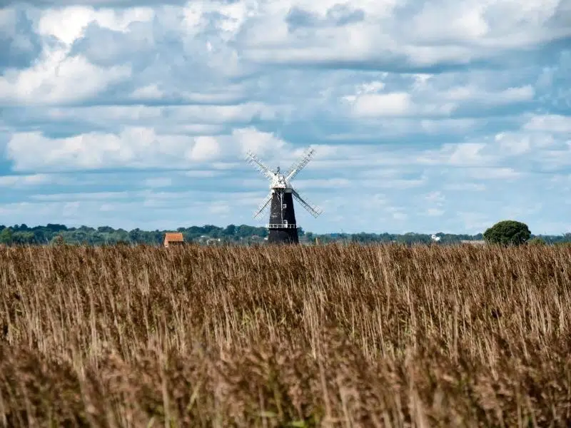
My absolute favourite is the visit to the remote Berney Arms railway station which serves the remote settlement of Berney Arms on the Halvergate Marshes. The station is several miles from the nearest road and is only accessible by train, on foot, or by boat from the River Yare.
Take the train from Great Yarmouth to Berney Arms – you’ll need to request the stop from the guard – and then explore the iconic Berney Arms Windmill before walking the five miles back to Yarmouth along the beautiful RSPB Breydon Water.
Links with:
- At the Berney Arms windmill, connect with the Wherryman’s Way as it heads into Great Yarmouth.
- Connects with the Weavers’ Way at Berney Arms station.
- Also at Berney Arms windmill, the Cross-Norfolk Trail is a 96 mile continuous east-west path across the county between King’s Lynn and Great Yarmouth, following some of Norfolk’s principal rivers, including the Nar, Wensum and Yare.
RELATED POST: 13 Exciting Things To Do in Great Yarmouth
South Walsham Circular Walk
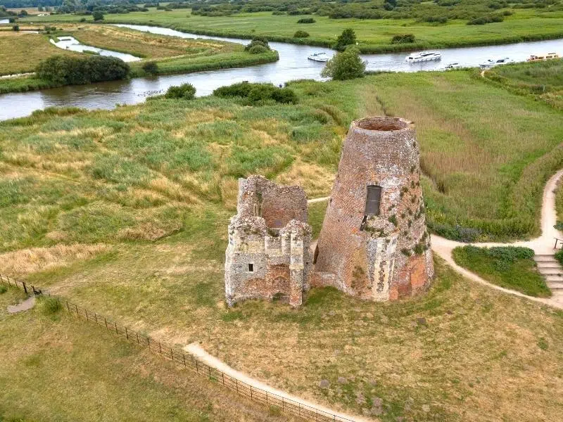
The tranquil and quiet route takes in some of the best of the Norfolk Broads navigable waterways including Fleet Dyke and the River Bure, with stunning views to the distinctive ruins of St Benets Abbey and the Cross of Peace.
The path passes the 18th century Tall Drainage Mill on the River Bure, open marshes and Upton Fen Nature Reserve, which you can stop and explore. Marsh harriers are frequently seen on this walk and barn owls are common in the evening, so make sure to take a pair of binoculars.
This 5 mile walk has two different starting points, which one you choose will depend on whether you arrive by car or boat! If you’re driving, the start point is from the car park in Pilson Green on the eastern side of South Walsham Broad, and moorings are available on Fleet Dyke. You can find a map and full details here.
Links with:
- Burlingham Woodlands Walks which pass through a gentle landscape of old and new woodland and orchards, with farmland interspersed by hedgerows.
RELATED POST: 26 Pictures of Norfolk England to Inspire Your Trip!
There is an excellent interactive Norfolk Broads walks map on the website of the Long Distance Walkers Association, which details trails and walks in Norfolk, both long and short. Just click through and scroll down to find the map, which you can then enlarge. Use the buttons to click for ‘other paths’ and see what pops up!
Wondering where to stay?
- Norfolk Glamping – 15 of the Best Spots
- Five Ideas for a Short Break in Norfolk
- The Six Best Campsites in Norfolk
- A Local’s Guide to the Norfolk Broads
- How about a boating holiday? Check out Norfolk Broads Direct for a fantastic range of holidays on the water.
Have I missed you favourite Norfolk Broads walk from my round up? Let me know in the comments below so I can include it in this list of walks in the Norfolk Broads!
Love it? Pin it!