
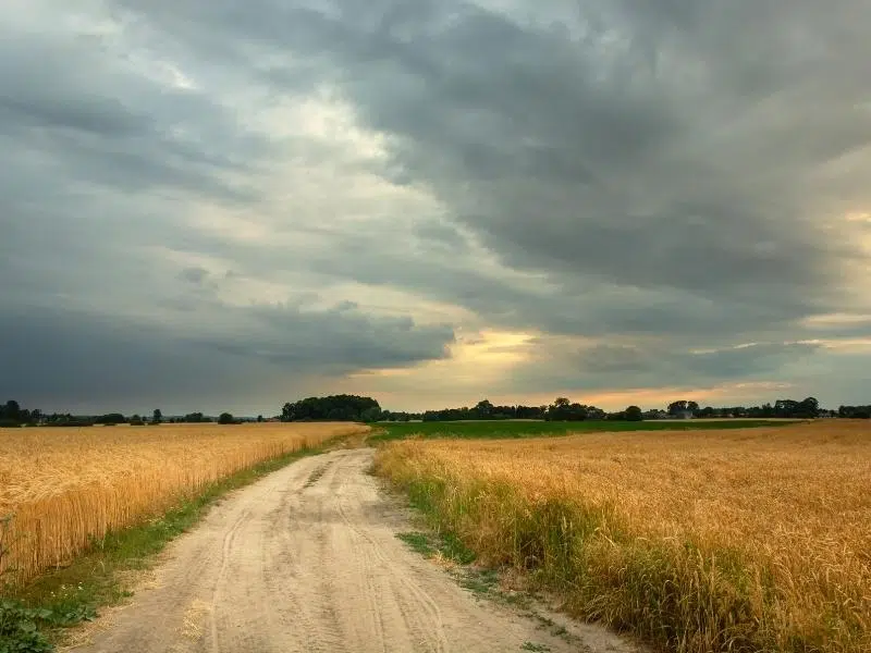
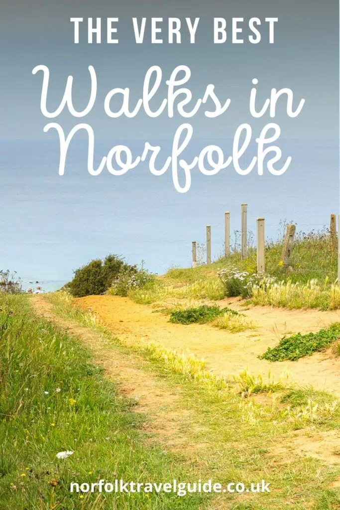
The beautiful landscape of Norfolk is perfect for walking. Richly agricultural and low lying, with huge skies and dramatic moments, Norfolk is ideal for hikers who enjoy exploring natural surroundings and local culture.
From multi-day national trails, deserted coastal walks and riverside paths, to heritage trails through lush countryside and pretty Norfolks villages, there are walks here for serious hikers, day trippers, amblers and families alike.
I’ve put together a guide of my favourite walks in Norfolk, with links to downloadable walking maps and specific directions. All you need to do is pack a picnic, get your boots on and get walking!
RELATED POST: The Ultimate Local’s Guide to Norfolk England
This post may contain affiliate links. If you book something I recommend, I make a small commission without affecting the price you pay!
Thanks to Norfolk County Council for providing maps and information.
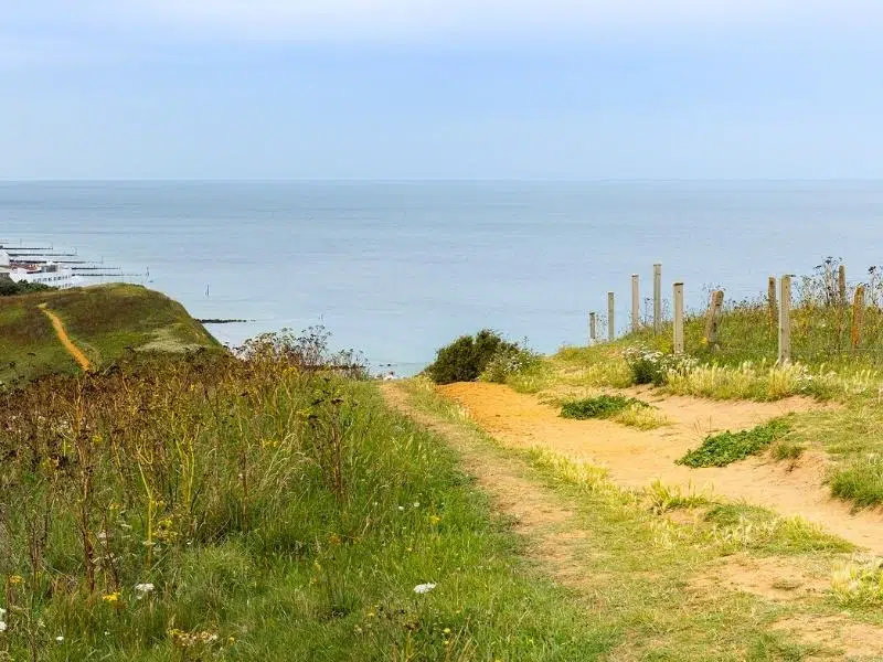
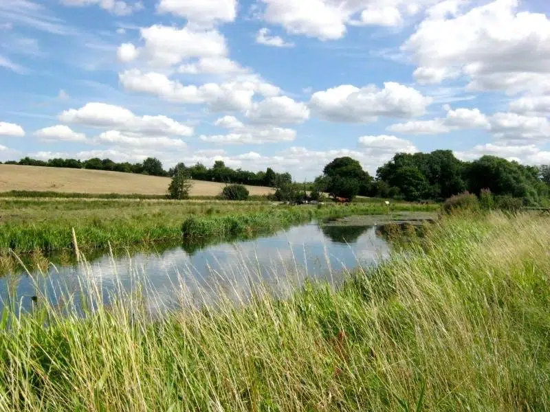
Norfolk Coast Path
Very probably the best loved of the Norfolk trails, and one of the best ways to experience the wilderness and unique landscapes of the Norfolk coastline, the Norfolk Coast Path runs from Hunstanton in West Norfolk, to Hopton-on-Sea in south Norfolk, where Norfolk meets Suffolk.
The path runs for 84 miles, and passes through the stark and beautiful landscape of the Norfolk Coast Area of Outstanding Natural Beauty. You’ll visit Norfolk coastal towns and villages along the way, encounter tidal marshes brimming with wildlife, and cross wide sandy beaches under the huge skies that Norfolk is famous for.
Hike the Whole Route
Walking the whole Norfolk Coastal Path will take around 28 hours, depending on your fitness level and walking pace. It’s easy to plan stops at pubs, hotels and campsites along the route, and most people plan to do the whole route in a week.
This allows for a mix of longer and shorter walking days, and a rest day if the weather is really poor, or you want to explore a particular spot.
Walk a Few Stages
If you don’t have the time or inclination to walk the whole route, do a few of the stages and then get the CoastLiner (which runs between Hunstanton and Wells-next-the-Sea) or CoastHopper (which runs between Wells-next-the-Sea and Cromer) back to where you’re staying.
I think one of the best of these North Norfolk walks is Hunstanton to Thornham, a six mile stretch which will give you a real flavour of the wild and raw nature of this part of Norfolk’s coastline.
Norfolk Coastal Walk – Hunstanton to Thornham
- The Norfolk Coast Path begins by the bowling green in Hunstanton. Pick up and follow the black and white National Trail acorns from here. Walk past the Lighthouse at Old Hunstanton and look out for the nearby ruins of St Edmund’s Chapel dating back to 1272.
- At the RNLI lifeboat station the route goes straight ahead, initially following behind the dunes and alongside Hunstanton golf course. Just before the final beach hut, waymark signs will direct you to go up onto the dunes from where there are fantastic views of the expanse of Holme Beach and Hunstanton cliffs.
- At Holme Beach you meet the end of the Peddars Way. As you follow the boardwalk through the Holme Dunes Nature Reserve, the beach to your left is where the 4000 year old timber circle, known as Seahenge, was discovered.
- Please follow the waymarking carefully to avoid nesting birds in the dunes on this National Nature Reserve managed by the Norfolk Wildlife Trust.
- At Old Thornham Harbour continue along Staithe Lane until your reach The Lifeboat Inn, for a well deserved cold drink!
- From here it’s a 30 minute walk to the excellent RSPB Titchwell Marsh, or walk the five minutes to where Church Street meets the A149, where you’ll find The Orange Tree bus stop.
- The CoastLiner 36 bus stops here on route to King’s Lynn via Hunstanton, at 13 minutes past every hour between 9am and 7pm.
Coast Path Circular Walks
There are also over 25 Norfolk Coast Path circular walks which incorporate parts of the trail, ranging from 1 to 9.5 miles. These walks take in various parts of the coastal route and pass thorugh villages, nature reserves and areas of special interest.
If you’re staying in one place and prefer to drive to the start point, circular walks are a great option as you can leave your car in one place, and not have to walk the route twice.
I love this 6 mile circular walk around Sheringham for its variety. You’ll discover an eclectic range of landscapes, from the undulating cliffs between Sheringham and Weybourne, the rolling parkland and ancient woodland of Sheringham Park to the quiet marsh, fen and grassland of Beeston Common. You might even see a North Norfolk Railway steam train chugging along the Poppy Line!
Links with:
- The Peddars Way at Holme-next-the-Sea, which heads south for 46 miles to Knettishall Heath in Suffolk.
- At Cromer, Overstrand, Trimmingham and Bacton, pick up the Paston Way which runs between Cromer and North Walsham and visits the areas historuc churches.
- Also at Cromer, link with the Weavers’ Way which runs south for 61 miles to Great Yarmouth.
RELATED POST: Norfolk Coast – 8 Amazing Ways to Explore
Wherryman’s Way
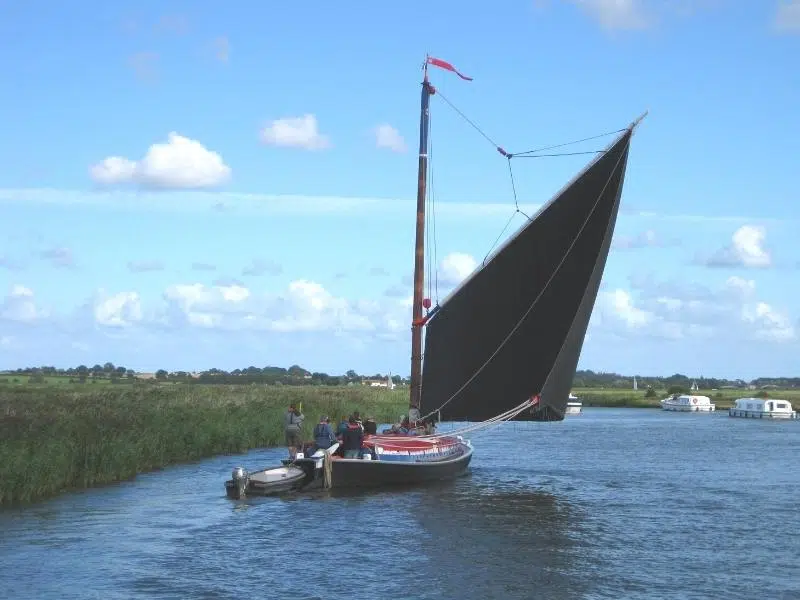
The best of the Norfolk river walks, the Wherryman’s Way can be walked or cycled and starts at the riverside opposite Norwich train station, before meandering all the way along the attractive River Yare in the Norfolk Broads National Park to the railway station in Great Yarmouth.
The route is named after the locals who plied their trade in traditional Norfolk wherries, boats which have been part of life on the Broads for hundreds of years. Sadly there are only eight remaining wherries on the Broads from a cast of hundreds in the 19th century. You can sometimes see their distinctive sails across the fields as they move along the inland waterways.
The 37 mile route passes historic ruins, pretty villages, riverside pubs and Sites of Special Scientific Interest, which reflect the rich wildlife diversity of the Yare Valley. Whether you are lucky enough to spot rare species, or enjoy the abundant and colourful landscape, you will not be disappointed.
The Wherryman’s Way is followed by public transport almost all the way from start to finish, meaning that you can walk or cycle as much of the path as you want and catch a bus or train back to your starting point, and your holiday accommodation. This is ideal if you don’t want to go too far, or you’re walking with small children.
There are twelve circular walks in Norfolk which link up with The Wherryman’s Way, ranging from 1.5 miles to 7.5 miles in length, so there will definitely be a route to suit your timeframe. Waymarkers along the route include stainless steel wherry sails, life-like figures, information panels and audio points, which help to make the walk engaging for kids.
This excellent book, The Wherryman’s Way, by Norfolk local hiker Joe Jackson, includes maps and directions of the entire trail with suitable overnight stops and locations of all facilities, points of interest and public transport information, and will help you get the most from the trail, especially if you’re planning to walk the full 37 miles.
Links with:
- The Weavers’ Way at Great Yarmouth as it heads through the Broads to Cromer.
- The Neslon Way, also at Great Yarmouth, a 404 mile long distance route from Burnham Thorpe in North Norfolk (Nelson’s birthplace), and linking locations associated with Admiral Lord Nelson.
RELATED POST: 13 of the Best Norfolk Broads Walks
Fen Rivers Way
The Fen Rivers Way is a long distance trail running for 50 miles between Cambridge, Ely, Downham Market and King’s Lynn, which traces the course of the rivers that drain slowly across the Fens into the Wash. The route takes you through the distinctive Norfolk Fens landscape and traditional Norfolk market towns on a path rich in history and wildlife.
Taking in the internationally significant environment of the Ouse Washes Nature Reserve, the journey follows the River Great Ouse under huge skies and through the dramatic landscapes and past the massive floodbanks that protect the low lying Fens.
This is the landscape of my upbringing – as a teenager I yearned for mountains and some relief from the relentless flatness of the Fens – as an adult, the endless skies and long views to the horizon mesmerise me.
If you don’t want to walk the whole route, pick it up at Downham Market where the A1122 crosses the River Great Ouse Relief Channel, for 12 miles of walking. Great Northern operate an hourly service between King’s Lynn and Downham Market, making returning to the start point easy.
Links with:
- At King’s Lynn, the Fen Rivers Way connects with the Wash Coast Path along the remote coast marshes into Lincolnshire.
- Also at King’s Lynn, link with the Nar Valley Way which leads east into the heart of Norfolk.
RELATED POST: All the Best Things To Do in King’s Lynn Norfolk

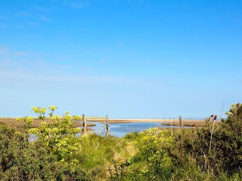
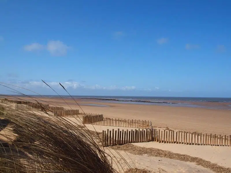
Blakeney Point Walk
Blakeney Point is a four mile shingle spit that juts out from the coastal village of Blakeney into the North Sea, and runs parallel to the coast. The area, managed by the National Trust, is important for breeding wildlife and is home to a large colony of Common and Grey seals.
There is a fantastic 3.5 mile linear walk (7 mile return walk) out to the point from the Norfolk Wildlife Trust car park at Cley Beach to the Point, through the Blakeney National Nature Reserve and the Norfolk Area of Outstanding Natural Beauty. One of the best Norfolk nature walks, you’ll pass marshes, sand dunes and vegetated shingle, seeing plenty of bird life as you go.
Blakeney Point Walk
- From the NWT car park at Cley Beach walk onto the shingle ridge towards the sea and turn left. When the tide is out, you can walk along the beach, which is much easier underfoot.
- Half way along the ridge you will come across the very photogenic Watch House, continue along the beach for another mile from here.
- At the start of the main dunes, walk onto the top of the ridge and turn left, away from the sea.
- Continue along the track towards the blue Lifeboat House, keeping the main dunes and fence line on your right. In this area there may be seals outside of the fence lines – ensure you give them a wide berth as they can be particularly aggressive, especially if they have a pup.
- Once you reach the crest of the boardwalk you have arrived at the furthest point of the walk. From here there are fantastic elevated views of the surrounding dunes and landscape. You may also see seals and their pups here during breeding season. Please do not enter fenced areas, for your own safety and that of the seals.
- From here, turn right and walk back along the beach, with the sea on your left, returning all the way to Cley Beach car park.
Dogs are not allowed on Blakeney Point between 1st April and 15th August due to ground nesting birds, and at all other times must be kept on short leads. Although you may see seals on the walk, it is not possible to see the seal colony on Blakeney Point on foot, as this part of the spit is closed off. If you wish to see the seals then you’ll need to take a boat trip from Blakeney or Morston Quay.
Links with:
- The Norfolk Coast Path at Cley Beach car park, heading west to Hunstanton and east to Great Yarmouth.
RELATED POST: Norfolk Beaches – Ultimate A-Z Guide
Weavers’ Way
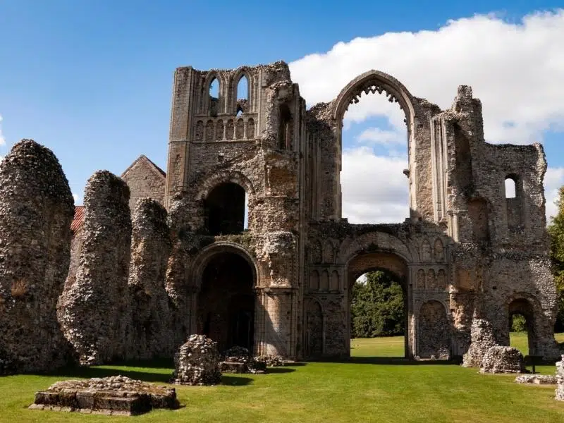
The Weavers’ Way runs from Cromer for 61 miles through the Norfolk countryside, taking in the National Trust properties of Blickling Estate and Felbrigg Hall, the pretty village of Hickling, iconic Thurne Mill and Breydon Marshes before arriving at Great Yarmouth on the east coast of Norfolk.
Named after the weaving industry which dominated medieval trade in Norfolk and gave the county its’ wealth, this historic trail passes through a diverse landscape of woodland, mixed farmland, historic country estates, disused railway lines and riverside walks, showing off the best of Norfolk.
There are nineteen circular walks branching off the Weavers’ Way, ranging from 1.25 miles to 7 miles long, so there’s something for everyone along this beautiful trail.
One of my favourites is the Potter Heigham 5.8 mile circular walk, which takes you across the Potter Heigham medieval bridge, believed to date from 1385, and through beautiful lush meadows and the woodlands of Hickling Broad National Nature Reserve before returning alongside the River Thurne to the village, where you can treat yourself to lunch or afternoon tea!
Links with:
- At Cromer, join the Norfolk Coast Path which heads west, right along the coast to Hunstanton.
- Also at Cromer, join the Paston Way, which meanders along to link again with Weavers’ Way, in North Walsham.
- At Aylsham join the Marriott’s Way to Norwich.
- At Great Yarmouth pick up the Wherryman’s Way to Norwich along the Yare Valley.
- Also at Great Yarmouth, you can connect with the Angles Way, which meanders along the Waveney Valley.
RELATED POST: 14 Stately Homes in Norfolk to Visit
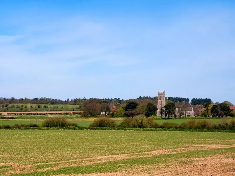
Paston Way
The Paston Way is a 22 mile walk between Cromer and North Walsham, discovering the beautiful historic churches, pretty villages and rolling farmland of north east Norfolk.
Each church has its own fascinating history, and one was even moved a brick at a time from the nearby clifftop, to save it from the encroaching sea! To visit all fourteen of the fine churches on the Paston Way, the trail covers 29.5 miles.
As you walk from church to church, the trail meanders along peaceful lanes, through picture perfect towns and villages, between vast fields of crops, over disused railway lines and across grazing pastures with glimpses of the Norfolk coast.
The route takes its name from the Paston family, writers of the famous Paston Letters, and wealthy landowners in the area during the medieval and Tudor periods. The family in turn had taken their name from the small village of Paston on the north east Norfolk coast.
To return to Cromer from North Walsham, get the regular Greater Anglia train service or the 6A or 33 bus from the North Walsham Travel Hub.
Get the route, interactive map and points of interest, including all the churches, here.
Links with:
- At Cromer, Overstrand, Trimmingham and Bacton, join the Norfolk Coast Path which heads west to Hunstanton or east towards Great Yarmouth.
- Join the Weavers’ Way which heads south to Aylsham at both Cromer and North Walsham.
- Pick up the Bittern Line Railway Ramble at North Walsham.
RELATED POST: Norfolk Churches: 16 of the Best to Visit
Nar Valley Way
The Nar Valley Way is a 34 mile long walk, running from the historic port of King’s Lynn to the Museum of Rural Life at Gressenhall, which follows the River Nar. The route follows Public Rights of Way, tracks and minor roads, and passes through Shouldham Warren, a fascinating environment where the Brecks and Fens merge and the landscape changes quite abruptly.
The Nar Valley Way is also a popular geocaching route, with ten caches on a 2.5 mile stretch from Castle Acre to West Acre, one of the most beautiful stretches of the Nar Valley Way, which also passes through Castle Acre Common, a Site of Special Scientific Interest – the perfect place for a tresure hunt!
You can walk all or some of the Nar Valley Way in short sections of between 2.5 and 6 miles. These linear walks run the length of the Nar Valley Way, and most sections have a nearby bus stop, making returning to your start point easy. Find an interactive map of the route and sections here.
There are also nine circular walks which link with the Nar Valley Way, ranging from 2 miles to 10.5 miles. I really enjoy the 3.8 mile Narborough walk for the opportunity to spot kingfishers and barn owls.
Links with:
- At King’s Lynn, link with the Fen Rivers Way which heads south through the Norfolk and Cambridgeshire Fens.
- At Castle Acre join the Peddars Way which heads north to Holme or south to Knettishall Heath.
- At Gressenhall join the Wensum Way through to the Marriott’s Way at Lenwade where you can connect with the Cross Norfolk Trail to Great Yarmouth.
RELATED POST: 12 Norfolk Castles for You to Explore
Marriott’s Way Heritage Trail
The Marriott’s Way is a 26 mile footpath, bridleway and cycle route, which follows the routes of two disused railway lines and runs between Barn Road in the medieval city of Norwich, and the Bure Valley Railway station in the historic market town of Aylsham, home to Norfolk’s slow food movement and just one of three Cittaslow towns in the UK.
The Marriott’s Way has something for everyone, from families and casual walkers to ramblers, cyclists and horse-riders, and is accessible all year round. This is also one of the best walks in Norfolk for those less mobile who use wheelchairs or mobility vehicles, as there are suitable surfaces along much of the route.
Walk this trail for wonderful countryside, wildlife, public art, and a wealth of local history. Marriott’s Way itself is a county wildlife site and passes through many interesting landscapes and wildlife rich habitats, such as the Wensum River Valley and Whitwell Common.
You’ll see a variety of birds, wildlife and plants, including kestrels, owls, hare, deer and butterflies, and if you’re lucky, you may see otters or kingfishers!
Get the route, interactive map and points of interest here.
Links with:
- At Aylsham join the Weavers Way for Cromer to the north, and Great Yarmouth to the east.
- Also at Aylsham, link with the Bure Valley Path, a 9 mile footpath and cycle path to Hoveton and Wroxham, which runs alongside the entire length of the narrow gauge Bure Valley Railway.
- In Norwich, link with the Wherryman’s Way to Great Yarmouth.
- Also in Norwich, link with the Bouddica Way, which heads through the rolling countryside of south Norfolk to Diss.
RELATED POST: Walks in Norwich – 15 City Walking Routes
You may also enjoy…
- Dog Friendly Beaches Norfolk: The Best for Unleashed Fun!
- The 21 Best Gardens in Norfolk to Visit
- 23 Amazing Things To Do in Sheringham
- 26 Exciting Things To Do On the Norfolk Broads
- 30 of the Very Best Things To Do in Norfolk
- 21 of the Best Things To Do in Hunstanton
- Blakeney Norfolk: All You Need to Know Before you Go
- 10 Brilliant Reasons to Visit Norfolk!
Nelson Way
This 404 mile long distance walk celebrates Britain’s naval heritage and England’s finest sailor Admiral Horatio Nelson. It follows a route from Burnham Thorpe (Nelson’s birthplace), and links locations associated with Nelson between Norfolk and the HMS Victory, Nelson’s flagship in the Battle of Trafalgar, at the wonderful Portsmouth Historic Dockyard.
The Nelson Way is a fitting trail for Norfolk, also known as Nelson’s County. If like me, the thought of walking 404 miles is a bit much, I’m going to share my favorite bit of the route, from Burnham Thorpe to Holkham.
This 11 mile Norfolk hike through the wetlands, dunes and sands of Holkham National Nature Reserve will reward you with magnificent beach views and huge skies, which accompany you for much of the route.
Burnham Thorpe to Holkham Gap Walk
- Start at Nelson’s birthplace, just outside Burnham Thorpe. The Parsonage where Nelson was born no longer exists, but Nelson’s Barn, built in its place, has a plaque set into the flintstone wall to mark the spot. You can find the barn on Creake Road, south of the village.
- From Nelson’s Barn, walk half a mile north towards Burnham Thorpe, and turn right at Garner’s Row, then next left onto Walsingham Road, and next right onto Lowe’s Lane.
- Take a left into Church Lane and continue to All Saint’s Church, where Nelson’s father was the Rector. Nelson’s parents are buried in the church, and a bust of Nelson is set on the north wall of the chancel above the site of his parent’s grave.
- Exit the church and turn left, and continue until you meet a track. Cross this onto the Public Footpath directly opposite, and follow for around 1 mile, until you reach Wells Road in Burnham Overy.
- Turn left onto Wells Road and walk for 300m until you reach Mill Road.
- Turn right into Mill Road and walk for 90m until you see a grassy path forking to the left. Take this path.
- Follow the path for around 900m until you reach Burnham Road.
- Cross Burnham Road and pick up the track again and follow it round to the right for 500m.
- When you reach the first houses, cut right to meet the A149 Tower Road.
- Take a left on Tower Road, pausing to admire the view of Burnham Overy Windmill behind you.
- Continue on Tower Road into Burnham Overy Staithe, where Nelson learned to row and sail a dinghy at the age of 10, two years before joining the Navy.
- Continue for around 200m until you reach West Harbour Way, and take a left.
- If you’re ready for lunch or a cold drink, don’t turn left but continue on here for a few minutes until you reach The Hero, a fittingly named and really good pub!
- Follow West Harbour Way for 500m, passing the pretty river front and boatyards. You will see a sign for the Norfolk Coast Path as you pass the last line of boats. Take this route.
- Follow the Norfolk Coast Path for 4.5 miles to Holkham Gap.
- From here you can head up Lady Anne’s Drive to the A149 and get the CoastLiner bus back to pretty much anywhere west along the coast, or the CoastHopper bus which goes to nearby Wells-next-the-Sea and Cromer. Or continue on to the splendid Palladian Holkham Hall.
Links with:
- The Nelson Way follows the Norfolk Coast Path at Burnham Overy Staithe to Holkham Gap, and beyond to Hopton-on-Sea.
RELATED POST: Burnham Market – All You Need to Know Before You Go
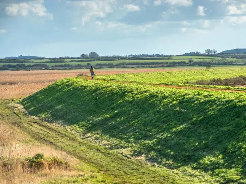
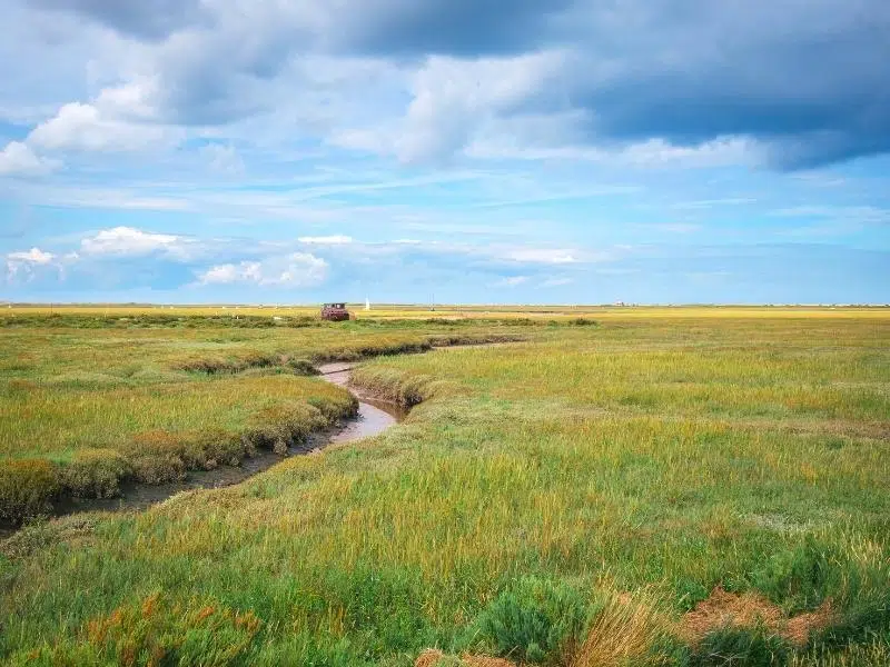
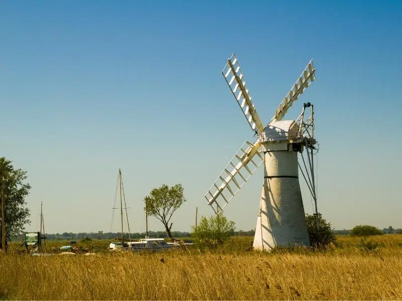
Horsey Mill Walk
Horsey, where the Norfolk Broads meet the coast, is a remote and secluded location, perfect for walking and bird watching throughout the seasons. There is an short but really popular 3.8 mile circular walk from Horsey Mill to Horsey beach, where you can also see the seal pups between late October through to February.
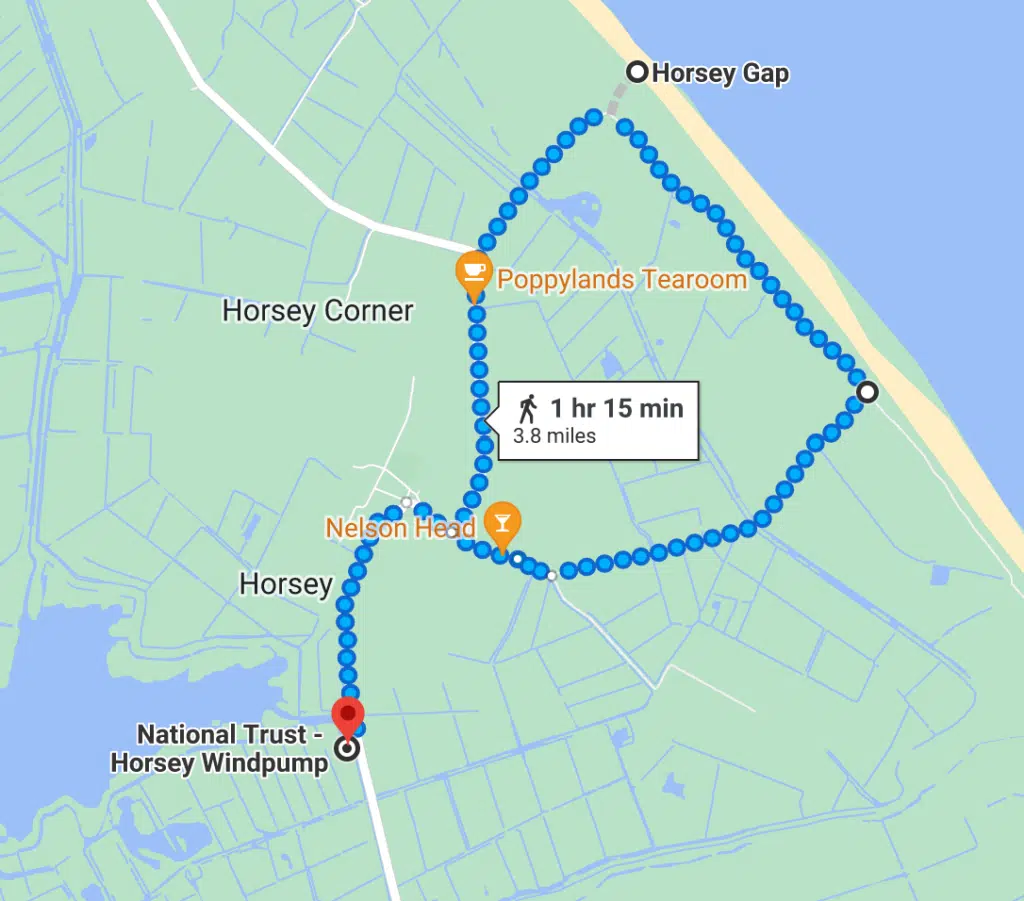
The Horsey Windpump car park is owned by the National Trust, and parking there if free for members. Otherwise, park at the Nelson Head car park in Horsey village, pop in and let them know you’re there, and then have a drink or lunch after your walk.
Most winters, over 2,000 seal pups are born, and it’s an incredible sight as you walk over the dunes to the viewing platform. Even if you’re visiting in summer, you’ll see seals bobbing along in the sea – popping up to have a nose when they know people are on the beach!
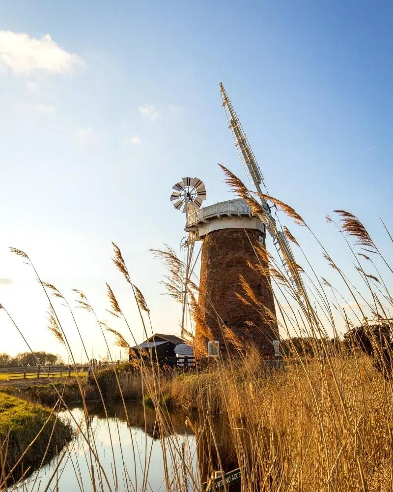
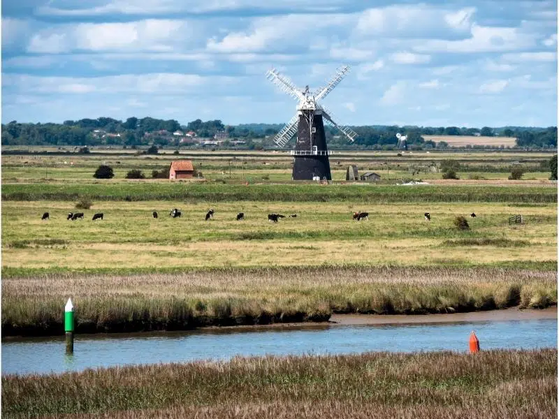
Horsey Windpump is an iconic 20th century drainage mill with a fascinating past. Standing watch over the Horsey Mere, a climb to the top is rewarded with stunning panoramic views of the surrounding countryside and Broadland landscape.
Horsey Windpump is owned by the National Trust, who restored the building after the mill was struck by lightening in 1943 and abandoned for 75 years. Now complete with a winding cap and turning sails, this delightful Grade II* listed building is one of the most photogenic buildings in Norfolk.
Links with:
- The Norfolk Coast Path at Horsey Gap as it heads south to Great Yarmouth, or north to Hunstanton.
RELATED POST: Seals in Norfolk – Where & How to See Them
Angles Way
Devised by the Ramblers, the Angles Way National Trail is a 93 mile walking trail which follows the county boundary of Norfolk and Suffolk, through the Waveney Valley and Little Ouse Valley, from Great Yarmouth to Thetford.
There are lots of excellent Norfolk circular walks which incorporate parts of the Angles Way, from 7 miles to 2 miles long. You can download maps and find information about the Angles Way here.
One of the best Great Yarmouth walks and my favourite part of the Angles Way, just inland from the town, is the 4.5 mile Burgh Castle walk.
You can ramble around the majestic third century Roman flint walls at the castle and on a clear day, you can see for miles with panoramic views across the River Yare and River Waveney to the grazing marshes, and the distinctive Berney Arms windmill in the distance, before heading back to town along Breydon Water, where the sea meets the Broads.
Links with:
- The Peddars Way at Knettishall Heath in the Suffolk Brecks, which runs all the way to Holme and the Norfolk Coast Path.
- The Bouddica Way at Diss, which heads through the rolling countryside of south Norfolk to Norwich.
- At Great Yarmouth pick up both the Wherryman’s Way to Norwich, passing through the Yare valley and Weavers’ Way heading through the Broads to Cromer.
RELATED POST: 13 Exciting Things To Do in Great Yarmouth
Wensum Way
The 12 mile Wensum Way connects the Gressenhall Farm and Workhouse Museum to Lenwade and bridges the gap between the Nar Valley Way and Marriott’s Way, north west of Norwich. The route passes through beautiful central Norfolk countryside, much of it alongside or close to the river.
The River Wensum takes its name from Old English word for ‘winding’, and is a designated Site of Special Scientific Interest, as well as a Special Area of Conservation. This walk passes close to 26 county wildlife areas and four Sites of Special Scientific Interest. Along the way, take in the far reaching countrywide views, pretty Norfolk villages and historic sites.
You can complete the Wensum Way in three short walks, and include a 3 mile stroll to or from the nearby market town of Dereham, for good public transport links to start or finish the trail.
- Gressenhall Museum to Swanton Morley – a 4 mile linear walk through rural central Norfolk countryside passing wildlife reserves and historic Hoe Hall along the way. Download here.
- Swanton Morley to Elsing – a 4.5 mile walk along the banks of the River Wensum between the central Norfolk villages of Swanton Morley and Elsing. Download here.
- Elsing to Lenwade – a 4.5 mile walk between the villages of Elsing and Lenwade that takes in the manmade lakes of Sparham Pools. Download here.
Links with:
- Links to the Marriott’s Way at Lenwade, and head north for Aylsham or south for Norwich.
- Also links to the Cross Norfolk Trail to Great Yarmouth, also at Lenwade.
- At Gressenhall, this route links with the Nar Valley Way, heading east to King’s Lynn.
RELATED POST: 21 Museums in Norfolk You Won’t Want to Miss!
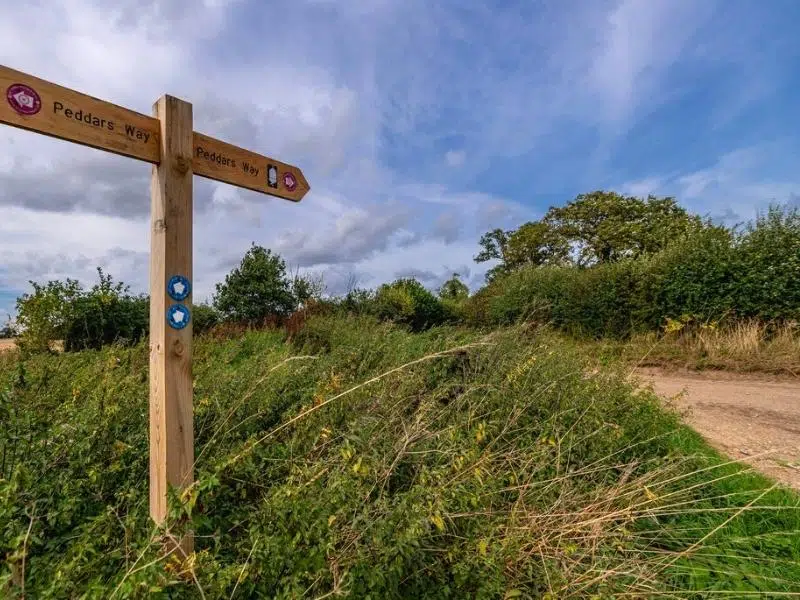
Peddars Way
The Peddars Way starts in beautiful Holme-next-the-Sea on the North Norfolk Coast and follows the route of a Roman road, built along the line of an even older trackway. The path runs for 46 miles to Knettishall Heath Country Park in the Brecks near Thetford, a unique area of forest, heath and low river valleys which sees little tourism.
A gentle walk through the Norfolk countryside, the Pedders Way rewards you with sweeping views over heathland and low river valleys. You will visit historic villages, medieval churches and ancient castles, and discover ever changing countryside on your route south.
Together with the Norfolk Coast Path to Cromer, the Pedders Way froms a national trail, and you can find out more about the route and places to visit here.
Links with:
- At Holme, pick up the Norfolk Coast Path which runs between Hunstanton and Hopton-on-Sea.
- At Castle Acre, you’ll meet the Nar Valley Way – head east to Kings Lynn and west for Gressenhall.
- Meet the Angles Way at Knettishall Heath, east of Thetford.
- Pick up the national Icknield Way Path at Knettishall Heath, which runs for 110 miles to Ivinghoe Beacon in Leighton Buzzard.
RELATED POST: 19 Top Things To Do in Thetford
Boudicca Way
Named after the legendary red-headed warrior and Queen of the Iceni whose tribes once inhabited the area, the Boudicca Way (pronounced boo·duh·kuh) runs for 36 miles between Norwich and Diss, roughly along the route of the old Roman ‘Pye’ Road, which is now the A140.
The Boudicca Way passes through the rural and gently rolling countryside of south Norfolk and the Waveney Valley using public rights of way and quiet country roads, where walkers will see local flora and fauna in abundance.
Along the way, the trail passes picturesque villages such as Shotesham, Saxlingham Nethergate, Pulham Market and Caistor St. Edmund, a settlement which can trace its roots to the Roman period.
The route starts at and finishes at mainline railway stations, making it a perfect option for those wanting to travel sustainibly. You can find an interactive map and more information here.
Links with:
- Links to the Angles Way at Diss, which heads east to Great Yarmouth, and west to Thetford.
- Pick up the Wherryman’s Way in Norwich for Great Yarmouth.
- Also in Norwich, link with the Marriott’s Way for Aylsham.
RELATED POST: Towns in Norfolk – 27 Towns to Visit in Norfolk
Have you walked any of these Norfolk hiking routes? Have I missed any of your favourite Norfolk walks? let me know in the comments below!
Love it? Pin it!

I’m addicted to hiking in Norfolk! I’ve done the Coast Path, Marriots, Wherryman’s, Boudicca, Angle’s Ways plus the Bure Valley walk, and am currently doing Weaver’s Way. After that it’s Peddar’s Way and then I’m not sure. I’m not into circular walking I prefer the ‘A to B then get a bus home’ approach. Is there another biggy I’ve missed?
Hi Gary have you thought about the Rebellion Way? It’s a new 232 mile circular cycle route around Norfolk but utilises quiet lanes and bridleways and can be used as a walking route. I’m about to write a post about it, so keep your eyes peeled!